Verfeinern Sie Ihre Suche
Auktionshaus-Kategorie
Kategorie
Sortieren nach:
- Kategorie
- Liste
- Galerie
-
58 Los(e)/Seite
Ein Abonnement der Preisliste ist notwendig um Ergebnisse, von Auktionen die vor einem längeren Zeitraum als 10 Tagen stattgefunden haben, ansehen zu können. Klicken Sie hier für mehr Informationen
Celestial.- Mariette (Pierre, publisher) Planisfere du Globe Celeste, double-hemisphere celestial map, said to be from the observations of the Dan...
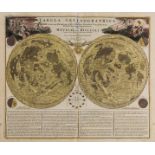
Celestial.- Homann (Johann Baptist) and Johann Gabriel Doppelmayr. Tabula Selenographica..., 1742.
Celestial.- Homann (Johann Baptist) and Johann Gabriel Doppelmayr. Tabula Selenographica, in qua Lunarium Macularum Exacta Descriptio Secundum Nom...
NO RESERVE Celestial.- Solar System.- Homann (Johann Baptist) & Johann Gabriel Doppelmayr. Systema Solare Et Planetarium, engraving with hand-colo...
NO RESERVE Celestial.- Woodthorpe (V[incent]) The Horizon, doube-page map of the horizon from Woolsey's ' Cellestial Companion or projects in plan...
NO RESERVE Celestial.- Goodacre (Walter) Map of the Moon, reduced map based on Goodacre's 77" diameter manuscript map of the moon, lithograph, 65...
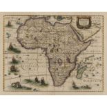
Africa.- Hondius (Henricus) Africae Nova Tabula, detailed and decorative map of the continent from 'Atlas Novus', featuring sailing ships, flying ...
South Africa.- De L'Isle (Guillaume) Carta Geografica Capo del Buona Speranza, [circa 1750]; and …
South Africa.- De L'Isle (Guillaume) Carta Geografica Capo del Buona Speranza, scarce map showing the second early expansion of the Cape of Good H...
NO RESERVE Algeria.- Seutter (Matthäus) Algercum munita metropolis Regni Algeriani..., bird's-eye plan of Algiers and its harbour, with two large ...
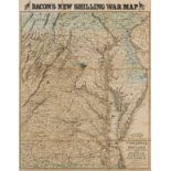
America.- Virginia.- Bacon (George W.) Bacon's New Map of the Seat of War in Virginia and Maryland, showing the interesting localities around Rich...
Mexico & Texas.- Wyld (James) Republic of Mexico and Texas, showing Texas as separate from the United States and from Mexico, engraving with hand-...
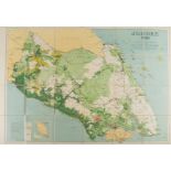
NO RESERVE Singapore & Malaysia.- Survey Dept. (Federation of Malaya) Johore, 1950, detailed map showing the topography of the region, with Singap...
Australia.- Gold mining.- Black (Adam and Charles) Austalia [Gold districts marked], [c. 1850]; …
Australia.- Gold mining.- Black (Adam and Charles) Austalia [Gold districts marked], engraving with hand-colouring, sheet 440 x 600 mm (17 1/4 x 2...
Australia.- Gold mining.- Wyld (James) Gold Regions of Australia, [1854]; and four other maps on …
Australia.- Gold mining.- Wyld (James) Gold Regions of Australia, engraving with hand-colouring, sheet 335 x 250 mm (13 1/4 x 9 7/8 in), minor sur...
Austria.- Vienna.- Homann (Johann Baptist) Prospect und Grund-Riss der Kayserl. Residenz-Stadt …
Austria.- Vienna.- Homann (Johann Baptist) Prospect und Grund-Riss der Kayserl. Residenz-Stadt Wien mit Negst Anligender Gegend und Neuen Linien u...
Czech Republic.- Platzer (Thaddeus and Leopold) Grundriss der K. Stadt Karlsbad, plan of Karlovy Vary, engraved by Joh. Berka, with full original ...
Europe.- Visscher (Nicolas) Europa delineata et recens edita..., engraved map with early hand-colouring, on laid paper, platemark 440 x 560 mm (17...
France.- Beaulieu (Sébastien Pontault de) 21 plates from 'Les glorieuses Conquêtes de Louis-le-Grand, Roy de France, et de Navarre', including a f...
France.- Fourteen maps including Braun & Hogenberg's plans of Macon and Chalons, 17th and 18th …
France.- A group of maps including Braun & Hogenberg's plans of Macon and Chalons, engraving with hand-colouring, c. 1617; F.de Witt's Generalis L...
France.- Paris.- Vue Generale de l'Exposition Universelle et des Constructions elevees dans le …
France.- Paris.- Vue Generale de l'Exposition Universelle et des Constructions elevees dans le Parc, wood-engraved bird's-eye view of the exhibiti...
France.- Paris.- Crépy (Jean Baptiste) Nouveau Plan Routier de la Ville et Faubourg de Paris, 1763.
France.- Paris.- Crépy (Jean Baptiste) Nouveau Plan Routier de la Ville et Faubourg de Paris, engraving with hand-colouring, sheet 570 x 790 mm (2...
Germany.- Hamburg.- Homann Heirs. Des Heil. Rom. Reichs freye Handels u. Hansee Stadt Hamburg in …
Germany.- Hamburg.- Homann's Heirs. Des Heil. Rom. Reichs freye Handels u. Hansee Stadt Hamburg in einem accuraten Plan u. Prosp., engraved plan a...
Holy Land.- Jerusalem.- Savery (Jacob) De Heylige en Wytvermaerde Stadt Ierusalem Eerst Genaemt …
NO RESERVE Holy Land.- Jerusalem.- Savery (Jacob) De Heylige en Wytvermaerde Stadt Ierusalem Eerst Genaemt Salem, imaginary bird's-eye view of anc...
Holy Land.- Conder (Thomas) A Map of The Land of Canaan, 1799; and 2 others of the region (3)
Holy Land.- Conder (Thomas) A Map of The Land of Canaan, engraving with hand-colouring, 350 x 360 mm (13 3/4 x 14 1/8 in), old folds as issued, ha...
Holy Land.- Clarke (Samuel) The Holy Land, large folding wall map showing from Damascus to Petra, with inset maps of the topography of Jerusalem a...
India.- Wyld (James) Map of the Peninsula of India, from the 19th Degree of North Latitude, to …
India.- Wyld (James) Map of the Peninsula of India, from the 19th Degree of North Latitude, to Cape Comorin, large two-sheet map of India with par...
India & Sri Lanka.- Coronelli (Vincenzo Maria) Penisola dell' Indo di qua del Gange, e l'Isola di …
India & Sri Lanka.- Coronelli (Vincenzo Maria) Penisola dell' Indo di qua del Gange, e l'Isola di Ceilan nell' Indie Orientali Descritta..., map o...
Indonesia.- Stemfoort (J.W.) and J.J. Ten Siethoff. Atlas van Nederlandsch Oost-Indië, 21 maps of …
Indonesia.- Stemfoort (J.W.) and J.J. Ten Siethoff. Atlas van Nederlandsch Oost-Indië, title with inset key map, 21 maps on 16 double-pages, litho...
Italy.- Rizzi-Zannoni (Giovanni Antonio) Li Regni di Sicilia, e Sardegna, colle adiacenti isole di …
Italy.- Rizzi-Zannoni (Giovanni Antonio) Li Regni di Sicilia, e Sardegna, colle adiacenti isole di Corsica, Elba, Malta, e Liparee..., engraving w...
Italy.- Venice.- Laurie & Whittle (publishers) A View from St. Marks Pillar at Venice; A View of …
Italy.- Venice.- Laurie & Whittle (publishers) A View from St. Marks Pillar at Venice; A View of the Bridge on the Canal Reggio, a pair of vue d'o...
Turkey.- Münster (Sebastian) Constantinopel des Griechischen Keyserchumbs Hauptstatt, [c. 1550].
Turkey.- Istanbul.- Münster (Sebastian) Constantinopel des Griechischen Keyserchumbs Hauptstatt/ im Land Thracia am Moere Gelegen, bird's-eye view...
Middle East.- Red Sea.- d'Anville (Jean Baptiste Bourguignon) Persian Gulph From the Original by …
Middle East.- Red Sea.- d'Anville (Jean Baptiste Bourguignon), After. Persian Gulph From the Original by D'Anville, chart of the Persian Gulf by G...
Middle East.- Cassini (Giovanni Maria) Gli Imperi Antichi Parte Occidentale; Gli Imperi Antichi …
Middle East.- Cassini (Giovanni Maria) Gli Imperi Antichi Parte Occidentale; Gli Imperi Antichi Parte Orientale, two part map of the Turkish Empir...
New Zealand.- Reid (John) Map of the Province of Otago New Zealand, hanging lithographic wall map with hand-colouring, 1080 x 980 mm (42 1/2 x 38 ...
Russia.- Sanson (Nicolas) Description de la Tartarie Tiree en Partie de Plusieurs Cartes, 1654; …
NO RESERVE Russia.- Sanson (Nicolas) and Pierre Mariette. Description de la Tartarie Tiree en Partie de Plusieurs Cartes, map of Tartary, showing ...
Russia.- St. Petersburg.- Bowles (John) [View of the Twelve Colleges building and part of the …
Russia.- St. Petersburg.- Bowles (John) [View of the Twelve Colleges building and part of the Merchant's Arcade in St Petersburg], vue d'optique e...
Switzerland.- Collection of 5 maps in cassetta-style frames, including 'Des Kantons Lucern Nordlicher Theil', 'Der Kanton Solothurn', 'Basiliensis...
Alps.- Matterhorn.- Kümmerly & Frey (publishers) Visp/ Viège-Zermatt-Gornergrat, [c. 1926]; and …
Alps.- Matterhorn.- Kümmerly & Frey (publishers) Visp/ Viège-Zermatt-Gornergrat, map of the Swiss and Italian Alps centred on Zermatt, lithograph ...
Atlases.- Speed (John) Title and frontispiece for 'The Theatre of the Empire of great Britaine', …
Atlases.- Speed (John) Title and frontispiece for 'The Theatre of the Empire of great Britaine', two sheets, engravings with full hand-colouring, ...
Atlases.- World.- Black (Adam and Charles) Black's General Atlas of The World, New and Revised …
Atlases.- World.- Black (Adam and Charles) Black's General Atlas of The World, New and Revised Edition, frontispiece with flags of nations, title,...
Arabic atlas.- Brocktorff (Frederico) Atlas, ay majmu' kharitat rasm al-ard..., published in …
Arabic atlas.- Brocktorff (Frederico, Maltese map publisher) Atlas, ay majmu' kharitat rasm al-ard..., 11 hand-coloured lithographic maps, includi...
Game.- Spooner (William, publisher) The Travellers of Europe; with improvements and additions, geographic game board featuring Europe, North Afric...
Game.- Wallis (J. & E.) The Royal Game of British Sovereigns Exhibiting the Most Remarkable Events …
Game.- Wallis (J. & E.) The Royal Game of British Sovereigns Exhibiting the Most Remarkable Events in Each Reign From Egbert to George III, spiral...
England & Wales.- Speed (John) The Kingdome of England, with eight costumed figures in margins, the seas populated with monsters and ships, engrav...
East Midlands.- Speed (John) Rutlandshire, with Oukham and Stanford her bordering Neighbour newely …
East Midlands.- Speed (John) Rutlandshire, with Oukham and Stanford her bordering Neighbour newely described, inset plans of 'Oukham' and 'Stanfor...
London.- Ogilby (John) The Road from London to Hith in Com. Kent, [circa 1676]; and two other road …
London.- Ogilby (John) The Road from London to Hith in Com. Kent, strip road map with London in the lower left corner, engraving with hand-colouri...
London.- Homann Heirs. Regionis, quae est circa Londinum, specialis repræsentatio geographica, 1741.
London.- Homann Heirs. Regionis, quae est circa Londinum, specialis repræsentatio geographica, map of the environs of London, from Maidenhead to B...
London.- Chiswick.- Bowles (Carington) A View of the Garden of the Earl of Burlington, at Chiswick; A View of Cain & Abel Bird-Cage... in Lord Bur...
London.- Tegg (Thomas) A New Plan of the Cities of London and Westminster, showing from Pentonville to Newington Butts and from Stepney Green to K...
London.- Illustrated London News (The) London in 1842, taken from the summit of the Duke of York's …
NO RESERVE London.- Illustrated London News (The) London in 1842, taken from the summit of the Duke of York's column, two bird's eye views of Lond...
NO RESERVE London.- Illustrated London News (The) [Panorama of the River Thames in 1845], one section only showing from the City of London to Gre...
London.- Newton (William) London Westminster Southwark as in Olden Times shewing the City and …
London.- Newton (William) London Westminster Southwark as in Olden Times shewing the City and Suburbs, large wall map, lithograph printed in colou...
London.- Weller (Edward) London, large nine sheet wall map, from the Weekly Dispatch, lithographs with full hand-colouring, conjoined in 3 horizon...
London.- Bacon (George W.) New Large-Scale Ordnance Atlas of London & Suburbs with Supplementary …
***Please note, the description of this lot has changedLondon.- Bacon (George W.) New Large-Scale Ordnance Atlas of London & Suburbs with Suppleme...
NO RESERVE London.- Bacon (George W.) New Map of London, divided into half mile squares & circles, from Cassell's Old & New London, lithograph wit...
London.- Bacon (George W.) Bacon's New Large Scale Atlas of London and Suburbs with Supplementary …
London.- Bacon (George W., publisher) Bacon's New Large Scale Atlas of London and Suburbs with Supplementary Maps, Letterpress Descriptions and Al...
Oxford.- Speed (John) Oxforshire described with ye Citie and the Armes of the Colledges of ye …
Oxford.- Speed (John) Oxforshire described with ye Citie and the Armes of the Colledges of ye famous university, county map with inset town plan o...
Oxford.- Sayer (Robert) A View of Queen's College (a), University College (b), All Souls College …
Oxford.- Sayer (Robert, publisher) A View of Queen's College (a), University College (b), All Souls College (c), the Steeple of St. Mary's Church ...
Newcastle.- Bowles & Carver (publishers) A South View of Newcastle upon Tyne in the County of …
Newcastle.- Bowles & Carver (publishers) A South View of Newcastle upon Tyne in the County of Northumberland, vue d'optique engraving with full or...
-
58 Los(e)/Seite


![Celestial.- Mariette (Pierre, publisher) Planisfere du Globe Celeste, [c. 1650].](https://portal-images.azureedge.net/auctions-2020/forum-10235/images/79f9478e-0616-463e-9a46-ac3f00c79169.jpg?w=155&h=155)

![Celestial.- Solar System.- Homann (Johann Baptist) Systema Solare Et Planetarium, [c. 1740].](https://portal-images.azureedge.net/auctions-2020/forum-10235/images/6a40c804-b273-490e-971b-ac3f00c80516.jpg?w=155&h=155)
![Celestial.- Woodthorpe (Vincent) The Horizon, [c. 1801-1803].](https://portal-images.azureedge.net/auctions-2020/forum-10235/images/250cedc2-7c05-4b48-ad5f-ac3f00c760bc.jpg?w=155&h=155)
![Celestial.- Goodacre (Walter) Map of the Moon, [c. 1910].](https://portal-images.azureedge.net/auctions-2020/forum-10235/images/63a7cdcf-fbb9-49bf-8f89-ac3f00c79550.jpg?w=155&h=155)
![South Africa.- De L'Isle (Guillaume) Carta Geografica Capo del Buona Speranza, [circa 1750]; and …](https://portal-images.azureedge.net/auctions-2020/forum-10235/images/8de71ed2-3547-4f31-b18a-ac3f00c82bf5.jpg?w=155&h=155)
![Algeria.- Seutter (Matthäus) Algercum munita metropolis Regni Algeriani..., [1732]](https://portal-images.azureedge.net/auctions-2020/forum-10235/images/49720dd7-8c8b-464d-949c-ac3f00c8097e.jpg?w=155&h=155)
![Mexico & Texas.- Wyld (James) Republic of Mexico and Texas, [c. 1845].](https://portal-images.azureedge.net/auctions-2020/forum-10235/images/df31279f-e427-471c-80fc-ac3f00c82eb0.jpg?w=155&h=155)
![Australia.- Gold mining.- Black (Adam and Charles) Austalia [Gold districts marked], [c. 1850]; …](https://portal-images.azureedge.net/auctions-2020/forum-10235/images/fe6a6ce3-8d27-4315-920f-ac3f00c7a438.jpg?w=155&h=155)
![Australia.- Gold mining.- Wyld (James) Gold Regions of Australia, [1854]; and four other maps on …](https://portal-images.azureedge.net/auctions-2020/forum-10235/images/106a65ab-7883-41a0-93ae-ac3f00c84c9f.jpg?w=155&h=155)
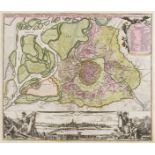
![Czech Republic.- Platzer (Thaddeus and Leopold) Grundriss der K. Stadt Karlsbad, [c. 1815].](https://portal-images.azureedge.net/auctions-2020/forum-10235/images/30ace36e-e3ee-415c-905d-ac3f00c77731.jpg?w=155&h=155)
![Europe.- Visscher (Nicolas) Europa delineata et recens edita..., [c. 1677].](https://portal-images.azureedge.net/auctions-2020/forum-10235/images/a4898b6d-9673-4603-ab75-ac3f00c847a2.jpg?w=155&h=155)
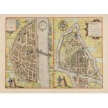


![Turkey.- Münster (Sebastian) Constantinopel des Griechischen Keyserchumbs Hauptstatt, [c. 1550].](https://portal-images.azureedge.net/auctions-2020/forum-10235/images/e872ea71-ae5c-46f3-ba50-ac3f00c785f2.jpg?w=155&h=155)


![Alps.- Matterhorn.- Kümmerly & Frey (publishers) Visp/ Viège-Zermatt-Gornergrat, [c. 1926]; and …](https://portal-images.azureedge.net/auctions-2020/forum-10235/images/e977c216-fd60-40f4-8dcb-ac3f00c77e19.jpg?w=155&h=155)


![London.- Ogilby (John) The Road from London to Hith in Com. Kent, [circa 1676]; and two other road …](https://portal-images.azureedge.net/auctions-2020/forum-10235/images/c8a5b45b-632e-4111-9c8d-ac3f00c7a10b.jpg?w=155&h=155)


![London.- Illustrated London News (The) [Panorama of the River Thames in 1845]](https://portal-images.azureedge.net/auctions-2020/forum-10235/images/eddd17c0-d1e6-4724-8ded-ac3f00c7478a.jpg?w=155&h=155)


![London.- Bacon (George W.) New Map of London, [c. 1880]; and seven others (8)](https://portal-images.azureedge.net/auctions-2020/forum-10235/images/97e7056b-ae3e-481c-9708-ac3f00c7c70b.jpg?w=155&h=155)


